Academic experts Industry outcomes
Our team at the University of Western Australia performs cutting edge research in machine learning and computer vision for industry partners, delivering commercial sofware solutions since 2011.
We have expertise spanning geochemistry, spectral analysis, geophysics and geodynamics. If you have interesting problems to solve in these areas, get in touch with us!
Key Projects

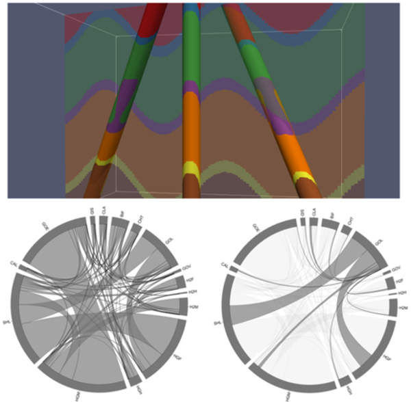
Drillhole Data Analysis and Integration
Machine learning, statistical approaches and image analysis are used to analyse and integrate multi-modal drillhole data. It resulted in two patent applications and is supported by Rio Tinto Iron Ore.

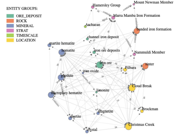
Geology Knowledge Mining
We developed a knowledge graph that determines semantic relationships between geological entities and terms from a large volume of mineral exploration reports. This research is a collaboration with UWA’s School of Computer Science and Software Engineering, and the Geological Survey of Western Australia.

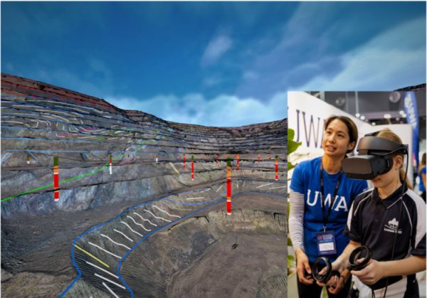
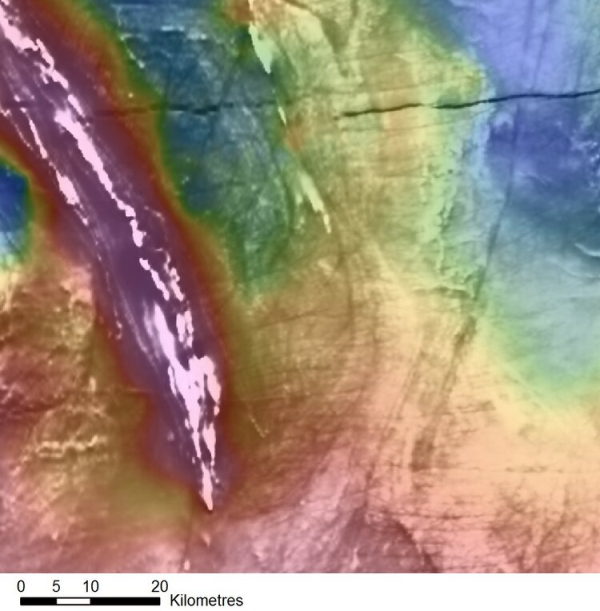
Mine Pit Visualisation
We are developing novel methods for visualising and interacting with 3D mine pit data. It facilitates off-site data analysis, historical data comparisons, and remote collaborations in partnership with Rio Tinto.

Software Releases

Integrated Exploration Platform
The IEP is a state-of-the-art GIS-based geodata analytics platform. It was developed in partnership with the Geological Survey of Western Australia, and was released as a public domain product to support mineral explorers operating in WA.

Click here for more information and to download.

CET Grid Analysis Extension and CET Porphyry Detection
These Oasis Montaj extensions allow enhancement, detection and delineation of features such as lineaments, structural complexity and porphyry targets from geophysical magnetic surveys.

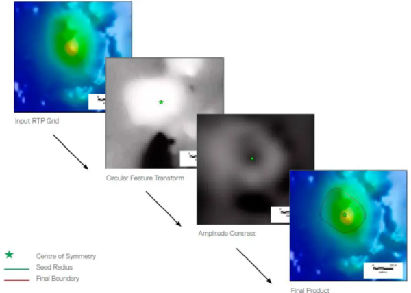
This software was commercialised, marketed and licensed by Seequent: click here for more details.

Automated Televiewer Image Analysis
Our automated structure picking and analysis methods were initially developed with Rio Tinto. It was commercialised in WellCAD’s Image & Structure Interpretation Workspace in an ongoing partnership with Advanced Logic Technology.

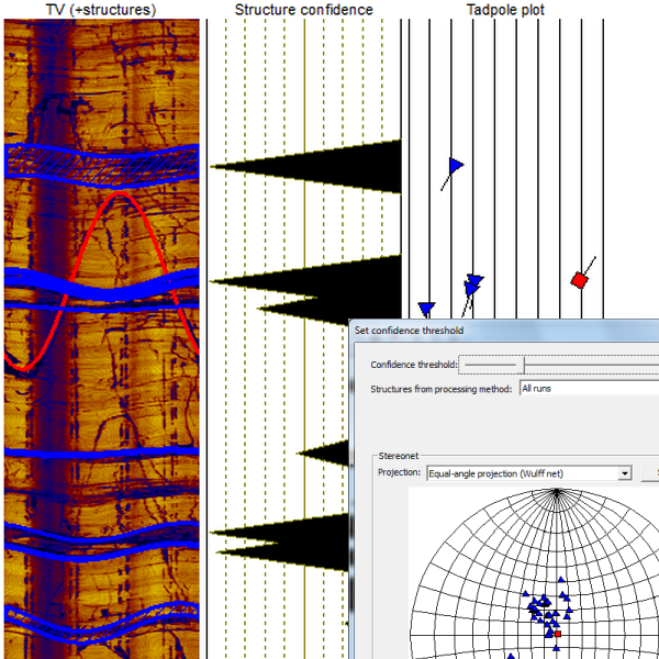
Now included in WellCAD's Image and Structure Interpretation Workspace.

ColorCET
Our perceptually uniform colour maps avoid misinterpretations due to uneven contrasts perceived in vendor colour maps. These colour maps have been made publicly available, and have been widely adopted by many vendors internationally.

More information and downloads are available here.

Meet the Team
Dr. Daniel Wedge
Read more
Dr. Tom Horrocks
Read more
Dr. Christopher Gonzalez
Read more
Daniel Hess
Alumni
Prof. Eun-Jung Holden
Read more
Prof. Peter Kovesi
Read more
Dr. Minh Tran
Dr. David Nathan
Read more
Dr. Tasman Gillfeather-Clark
Read more
Dr. Luke Smith
Read more
Contact us
Centre for Data-driven Geoscience
School of Earth and Oceans
The University of Western Australia
Robert Street Building
35 Stirling Highway
Crawley WA 6009
Australia
Email: daniel.wedge at uwa.edu.au